
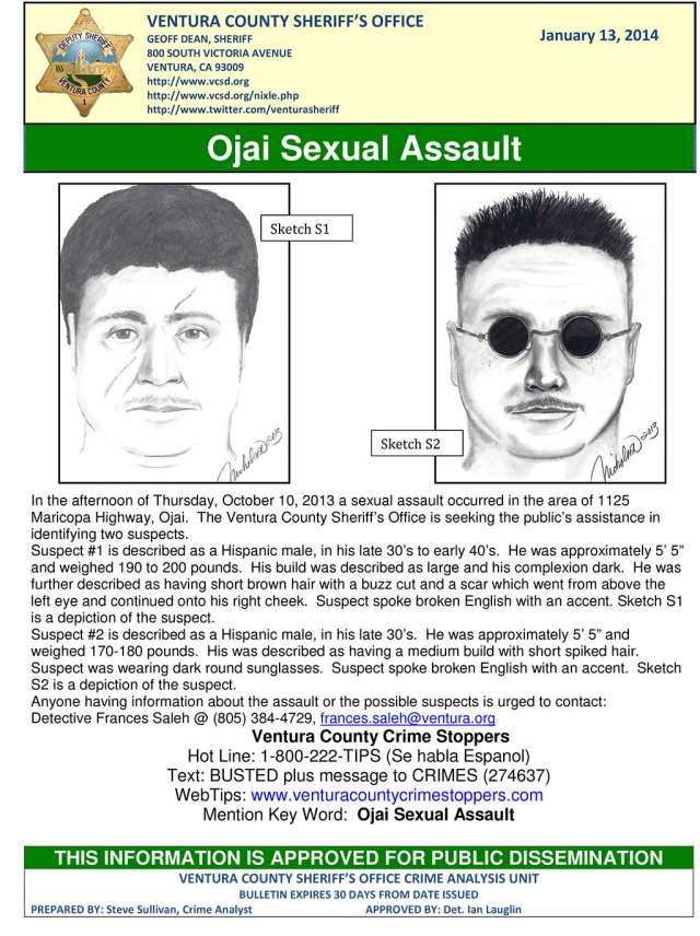

|
By Anonymous — Wednesday, January 15th, 2014
Party-goers questioned about evening’s events - Suspect being sought
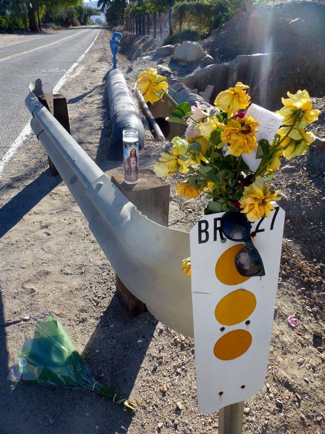
On Saturday, January 11 at 1:59pm, Sheriff’s deputies responded to a report of a gunshot victim laying on the road in the 1600 block of Grand Ave. Upon arrival, the deputies discovered two victims were shot near a party at a residence on Grand Ave. A male adult, Adrian Moreno, 18 of Fillmore, sustained fatal injuries. A second gunshot victim was taken to a local hospital with non-life threatening injuries. The investigation is continuing. A party of approximately 50 was taking place at the time. Morena sustained a gunshot wound to the chest. There are no suspects in custody. Investigators are seeking the public’s help. Anyone with information is urged to call Sheriff’s Major Crimes at (805) 384-4730. Information by Captain Don Aguilar Ventura County Crime Stoppers will pay up to $1,000 reward for information, which leads to the arrest and criminal complaint against the person(s) responsible for this crime. The caller may remain anonymous. The call is not recorded. Call Crime Stoppers at 800-222-TIPS (8477). |

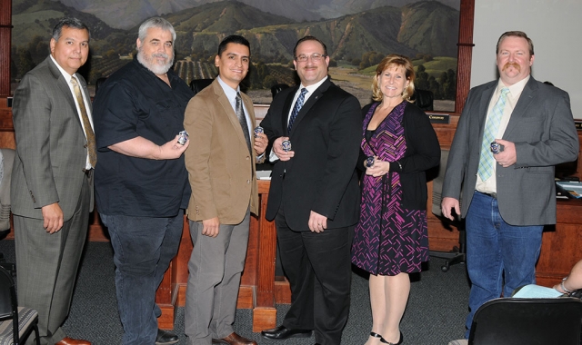 (l-r) Fillmore Fire Chief Rigo Landeros presented the Centennial Fire Badge to City Councilmember Steve Conaway, Mayor Manuel Minjares, Mayor Pro-tem Douglas Tucker, Councilmembers Diane McCall and Rick Neal. Enlarge Photo By Jean McLeod — Wednesday, January 15th, 2014
There were a number of agenda items on the first Fillmore City Council meeting of 2014. It began with a presentation by Fire Chief Rigo Landeros regarding the Centennial Celebration. Other items included Facility Use Policy, an ordinance for landlords to evict criminals from rental properties, and an introduction of some new additions to City Staff and Police. Fire Chief Rigo Landeros representing the Fire Foundation, presenting all Council Members, the City Manager and the Fillmore Firemen, with an embossed Fire Badge honoring Fillmore's Centennial Celebration. The badges will be worn by Fillmore's Fire Department throughout the year and then retired in a Lucite sleeve to be displayed at their homes or offices. Patrick Maynard, was also recognized for, among many other things, helping establish the Fire Foundation and obtaining grants adding up to $225,000 that went towards equipment such as breathing apparatus and radios. Maynard, who was not in attendance, also designed the Fillmore Centennial Logo. He will also be given a bottle of wine with the City Logo. Landeros also thanked all the organizations and individuals for the success of the Toy Giveaway in December, with thanks to the Sheriffs Department and a special thank-you to Maynard who did much of the organizing. This year’s giveaway saw the largest crowd of families since the program began 16 years ago. There were 362 toys given to boys, 373 to girls and 373 to adults in the community. Fillmore seems to CONTINUED » |

|
By Anonymous — Wednesday, January 15th, 2014
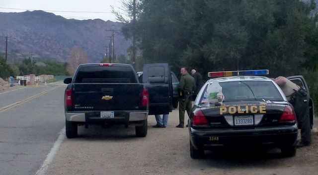
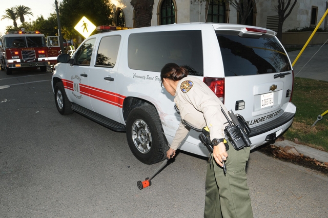 A Ventura County Sheriff marks off the location of a hit & run, which occurred on Wednesday, January 3, at approximately 4p.m. Fillmore Fire Chief Rigo Landeros’ city truck was parked at the curb on Santa Clara Avenue, just south of City Hall. A citizen witnessed the collision, telling Landeros it was a red truck, heading west-bound. Red paint was found on the city vehicle at the site of impact. Ventura County Sheriff Deputies located the red truck just east of Palm Street. No further details were available. Enlarge Photo |

|
By Anonymous — Wednesday, January 15th, 2014
The Fillmore Lions Club has announced that this year’s Student Speaker Contest will be held on February 3 – a Monday at the Fillmore Scout House at the end of Sespe Ave. Pole Creek. The topic will be “Community Service – What does it mean? And why does it matter?” The topic is interesting and very relevant to High School Students as all student have to do community service in order to graduate and as part of their High School curriculum. To be a good citizen it is necessary to volunteer in community activities and to do meaningful community service. This topic will be very interesting to the students and to the citizens of Fillmore. Chair Bill Edmonds states that the total prize money in scholarships and cash will again be over $21,000. The Fillmore winner will receive $75 and will advance to the next round. Runner ups will receive $25. The winner goes on to compete against the winners of other local Lions club contest on March 13 in Camarillo. All high school age youth who live within the Fillmore Unified School District boundaries are eligible to compete. This includes home taught students, foreign exchange students as well as Fillmore residents who attend another high schools. Students who wish to enter may contact Bill Edmonds at 524-4839 or Jennifer Fitzpatrick the FHS English teacher. Edmonds emphasizes that public speaking competition will be very worthwhile to the students and very interesting to their and to the community. Public speaking competition will also look very good on college applications and resumes. Students should get started early because it takes time to develop and practice a good speech. |
|
By Anonymous — Wednesday, January 15th, 2014
 Fillmore Unified School District The Cosca Group has been hired to locate candidates for the Fillmore Unified School District Superintendent position. A public meeting will be held in English/Spanish on Wednesday, January 22 at 6:30pm, Sespe Auditorium. It is located in the FUSD building. The public will be asked to contribute their opinions as to the strengths of the District, the critical needs of the District, and Characteristics sought in a new Superintendent. Walk-in option for giving input on Thursday, starting at 5pm, same location. |
|
By Anonymous — Wednesday, January 15th, 2014
 City of Fillmore 01/07/14 |
|
By Ventura County Sheriff Department — Sunday, January 12th, 2014
Investigators seek public's help
 Ventura County Sheriff's Department Sheriff's deputies responded to a report of a gunshot victim laying on the road on Grand Ave. Upon arrival, the deputies discovered two victims were shot near a party at a residence on Grand Ave. Adrian Moreno sustained fatal injuries. A second gunshot victim was taken to a local hospital with non-life threatening injuries. The investigation is continuing. Moreno was pronounced deceased at the scene. There are no suspects in custody. Investigators are seeking the public's help. Anyone with information is urged to call Sheriff's Major Crimes at (805) 384-4730. Nature of Incident: Homicide Near Fillmore Prepared by: Captain Don Aguilar Ventura County Crime Stoppers will pay up to $1,000 reward for information, which leads to the arrest and criminal complaint against the person(s) responsible for this crime. The caller may remain anonymous. The call is not recorded. Call Crime Stoppers at 800-222-TIPS (8477). |
|
By Anonymous — Sunday, January 12th, 2014
An 18-year of Fillmore man is dead and one was wounded after a Saturday night shooting. The crime took place at approximately midnight in the 1600 block of Grand Avenue. Its been reported that a large party was taking place in the area. The victim was reported lying in the street and was pronounced dead at the scene from gunshot wounds. Another victim was shot and received non-life threatening injuries. He is at Ventura County Medical Center. Names have not been released. Major Crimes detectives and crime scene investigators were at the scene interviewing witnesses. Ventura County Search and Rescue was on scene until 10:30am Sunday morning, looking for evidence in the shooting. A suspect is at large; anyone with information should call Sheriffs Major Crimes at 805-384-4730. |
|
By Manuel Minjares — Wednesday, January 8th, 2014
A message from Fillmore Mayor Manuel Minjares
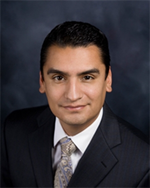 Mayor Manuel Minjares Having recently been selected by our City Council to serve as the City of Fillmore’s Mayor for our Centennial year, I am appreciative of the opportunity to let the citizens of our City, and all of Ventura County, know of the great strides that our community is making, and of our hopes and aspirations for the coming year. As many know, Fillmore has faced some significant financial challenges in the recent past. Rather than simply try to work within the constraints of these challenges, our City Council has worked together cooperatively and collegially to face down and successfully abate these challenges, and we are looking forward to brighter days ahead for our citizens. Our City Council, by continuing to work cooperatively with each other and with those at all levels of government, anticipates the ability to achieve success in many different areas during the coming year. Through a coordinated effort with the City of Santa Paula, the County of Ventura, and the Ventura County Transportation Commission, we anticipate developing and implementing a seamless system of transit and transportation for those in the Heritage Valley, a system that can become a model for other areas to emulate. By maintaining a close working relationship with Ventura County Sheriff Geoff Dean and our Police Chief, Monica McGrath, our City Council has continued to emphasize the value of a safe community and has focused law enforcement and community efforts on both crime prevention and firm, fair enforcement of our laws. We are also working hard to upgrade the environmental aspects of our community, coordinating with the Chamber of Commerce to attract new business to our downtown area, working with Caltrans to beautify the 126 corridor through town, supporting our Film Commission in their successful efforts to bring more filming to our City, and bringing community groups and economic development together to find common ground for making Fillmore an ever greater City to live in and raise a family. At the same time that we will be working on these issues, we also realize that there are significant challenges that we still must face on behalf of our residents. Due to federal and state regulations our City was required to build a wastewater treatment plant that although was very sophisticated and expensive for a community of our size, it will perform its needed functions well in the decades to come. Our City Council will be working closely this year with County, State, and federal officials to seek ways to bring our operating costs down for the benefit of our residents, never losing sight of our goal to lower our rates while maintaining all of the required environmental safeguards. Another challenge that we will face this year is that of finding a way to keep the Fillmore and Western Railroad a viable, operating, and safe tourist train. This train benefits not just the Heritage Valley, but is a major tourist attraction for Southern California. Unfortunately the need for costly maintenance of the tracks and their infrastructure, as well as the needed renewal of the lease for the operating rights on the tracks, have combined to cloud the future operation of this important regional attraction. Our City Council knows of the important economic benefits of Fillmore and Western, yet at the same time we also know the importance of a safe facility and the fiscal viability of the operation. Our City Council is proud of our community and we know that our residents are proud to call Fillmore their home. Our community continues to be shown in movies and on television worldwide as a picture-perfect downtown setting of small town America. Our shops and businesses are proud of this recognition and we invite all of Ventura County to stroll our downtown sidewalks on any weekend. We’re proud of our community and know that as all of Ventura County gets to know us, that same pride in Fillmore will spread throughout the County. And to our residents, friends, and governmental colleagues, thank you for your contributions to Fillmore’s first one hundred years. May our next hundred be as successful!! |