
|
The Road Well Traveled
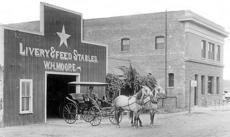 The Star Stable circa 1912, which was also part of the Inn and was located on Santa Clara and Central. Photos courtesy Fillmore Historical Museum. By Anonymous — Wednesday, March 24th, 2021
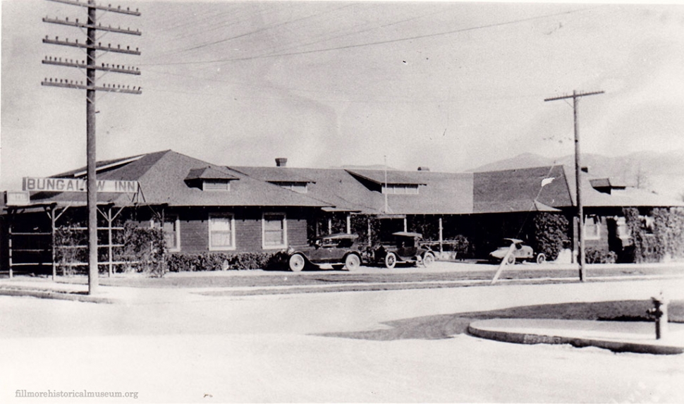 The Bungalow Inn on Santa Clara Street built in 1911. It had 20 rooms for many who traveled through Fillmore. 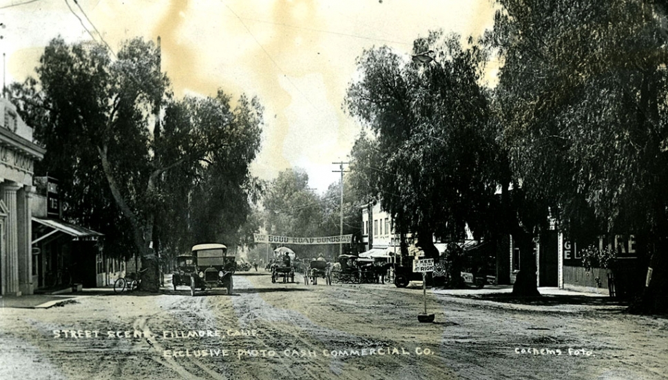 Central Avenue in 1915. 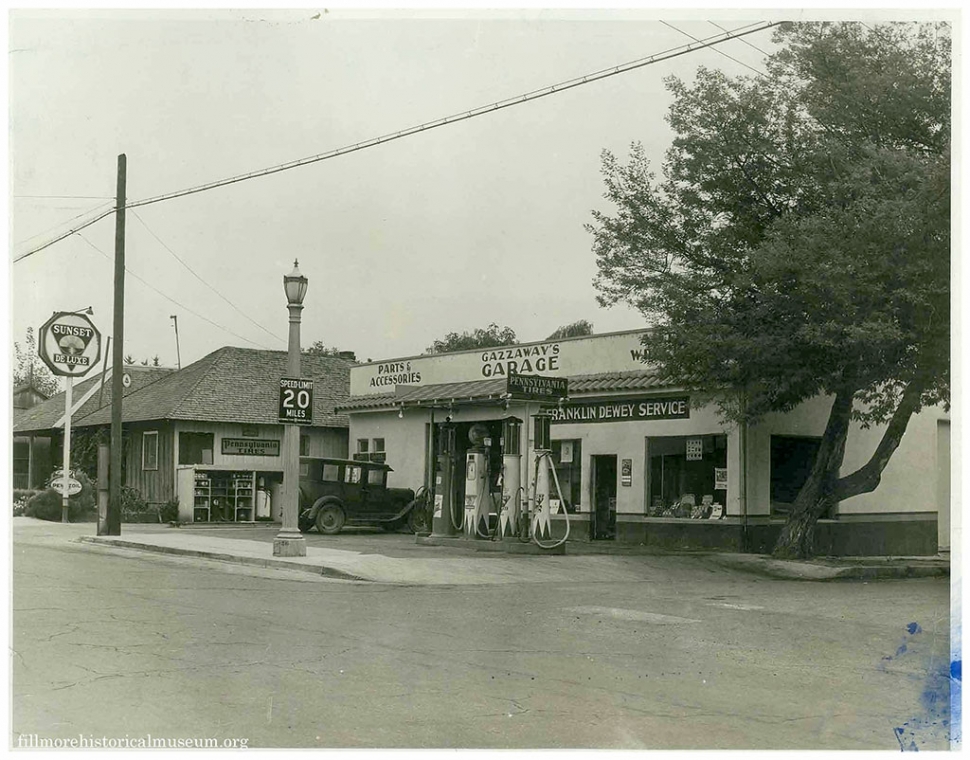 Santa Clara Street in 1925. 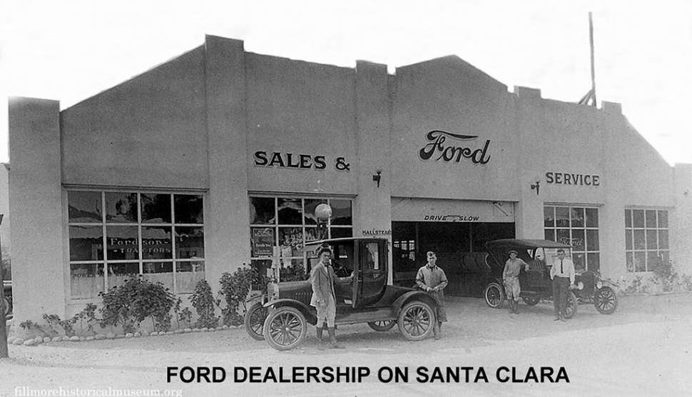 Fillmore Ford Dealership circa 1929. 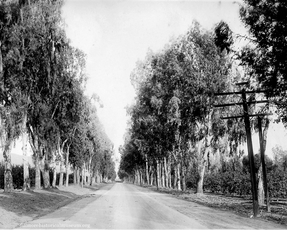 Rancho Sespe circa 1930. 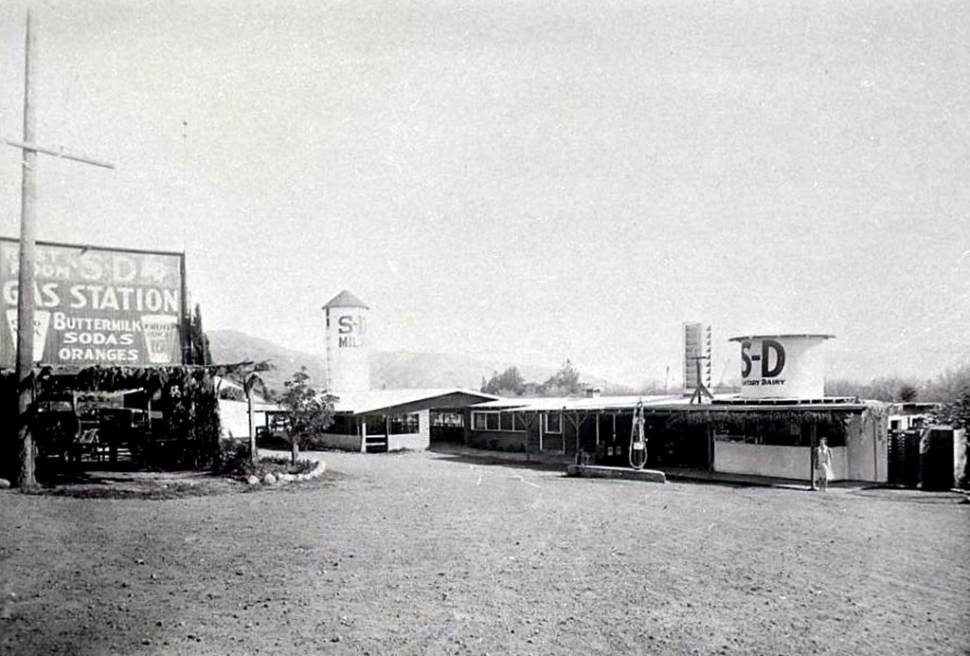 Sanitary Dairy in 1930. 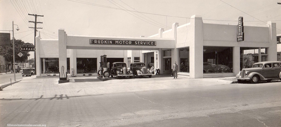 Rudkin Motor Service circa 1938. 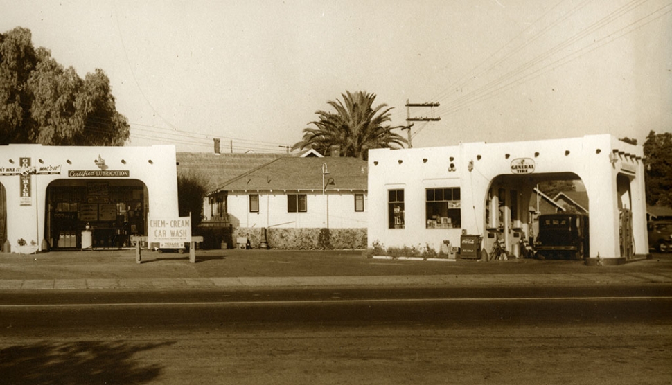 Seaside Rocket Service Station on Santa Clara and A Street. 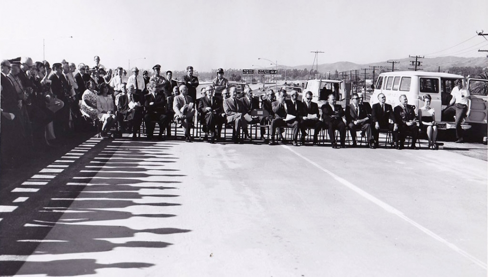 The Grand Opening of the Freeway Portion of Highway 126 in 1965 ending in Santa Paula. By 1971 studies were undertaken to determine the feasibility of completing the highway from Santa Paula to Hwy 5 at Castaic. Courtesy Fillmore History Museum We are all familiar with the roads into and out of Fillmore. But, the route was not always as it is today. In the earliest days there were no cities, only small villages of Chumash at Sak’spe (Sespe), the Mupu near today’s Santa Paula and the Aliklik, at Kamulos (Camulos). The route was a foot and horse path from the mountains to the coast. The path wandered as far north as what is now Kensington Drive. A clump of three sycamore trees marks the spot along which Pole Creek traversed the future town site and served as a gathering point and sheep shearing location long before Fillmore came into being. The Spanish had traveled the route on their explorations in 1769, followed by the Mexican land grantees in the 1830s and American settlers in the 1850s. Ventura and Santa Paula were already well established by 1887 when the railroad laid tracks along this route. The rails generally took the path following the same route as the earlier horse and wagon route through Piru, Fillmore and Rancho Sespe and the farms in between. Over time the path was widened to accommodate early automobiles. In 1915, Ventura County pushed for a vote to pave the main route through the county. The local ladies were anxious to have the road up Central Ave. paved because it was dusty and dirty. In order to keep the dust down, the local city fathers would periodically have the street oiled. Over the years, the ladies had become tired of the mess that was made when their long skirts dragged in the oil as they crossed Central Ave. When it was approved, paving followed the established, well-traveled pathway. The route entered Fillmore from the east as it does today with the crossing over Pole Creek which had earlier been rerouted to run south to the Santa Clara River. It took an immediate right turn up to Santa Clara St. It then followed Santa Clara west and made a right turn onto Central Ave, thence to Sespe St. where it turned left and followed Sespe St. to the Sespe River. Motels were unheard of in those days but there was always a place to stop in Fillmore at the Bungalow Inn on Santa Clara St. It was built in 1911 with 20 rooms, some with a bath should that be needed. There were stables along the way such as The Star Stable just east of the corner of Santa Clara and Central. The original road had crossed the Sespe at Muir St. but in 1914 a flood had destroyed the bridge. The day the Muir St. Bridge collapsed, Hilda Hurst was crossing the bridge in her buggy having taken friends into Fillmore to catch the train. She felt the horse bolt as it felt the bridge tremble. She made it to solid ground just as the bridge collapsed. After the collapse, the county decided to change the route and relocated the road from Muir St. to Telegraph Road. About 1916, Cliff Hardison, seeing a business opportunity, bought 10 acres along the road, ordered a silo from Sears Roebuck and opened the Sanitary Dairy complete with cows, roadside rest stop with picnic area and country store. Travelers could purchase fresh squeezed orange juice, fresh milk and watch the cows being milked in the milk barn. It became well known as a rest stop for weary travelers. For the next 60 years the dairy also supplied milk to residents of Fillmore and Bardsdale and local schools. In the teens, the route was again shifted and Santa Clara from Central Ave. to A Street became the main highway. It was no wonder that Santa Clara soon became home to the auto dealerships which had replaced the livery stables. The Ford dealership was east of Central. Wm. L. Morris purchased a gas station on the corner of Central and Santa Clara which by 1929 had become his Chevy Dealership. John Opsahl”s Studebaker was next door to the west. Rudkin’s Motor Service and Plymouth - DeSoto sales and service were on the north side pf the same corner and along the way were gas stations and repair shops. Until 1954, Santa Clara to A St. to Telegraph Road was the main thoroughfare between Castaic and Ventura. But that year, the county straightened the road extending it along Ventura Street and built a new bridge over each branch of Sespe Creek. This is the route through Fillmore still today. In 1975 the dairy closed because the traffic on the new road bypassed them and the tourists stopped coming. In 2021 a heavy wind so damaged the silo that it had to be taken down. Generations of Fillmore residents remember the view of the silo on their way back home from points west. Hwy 126 remained a bucolic route through the valley for many years. But the 1960s traffic had increased enough for the city and county to discuss a new freeway. By 1965 the freeway portion of Hwy 126 ending in Santa Paula was complete. In 1971 studies were undertaken to determine the feasibility of completing the freeway from Santa Paula to Hwy 5 at Castaic. Studies put the cost at $100 million. Public Works Director, A. P. Stokes was quoted as saying the following regarding the cost which was mostly for flood control and embankments, “It now appears that this flood control work is way off in the future and may never happen.” To date it hasn’t happened. In 1988 work began on adding two lanes to the existing road through Rancho Sespe west of Fillmore. It required removal of many of the huge eucalyptus trees and orchard trees along the route, replacing gas and electric lines and repaving the older sections of the road. This is the heavily traveled road we use today. Will there ever be a freeway all the way to I 5? Where would the route go? In 1960 the county published a map of potential freeways in Ventura County. This map included two freeway routes from Moorpark and Simi over the mountain to Fillmore and a 4 lane freeway to Hwy 99. The I 5 did not exist when that map was drawn. Our valley has changed drastically in the 134 years since the railroad was built. We are now becoming a bedroom community with heavy traffic every weekday in and out of town. We can only wonder what comes next. |