
|
FEMA Flood Insurance Update
 FEMA flood map zones By Bert Rapp — Wednesday, October 7th, 2009
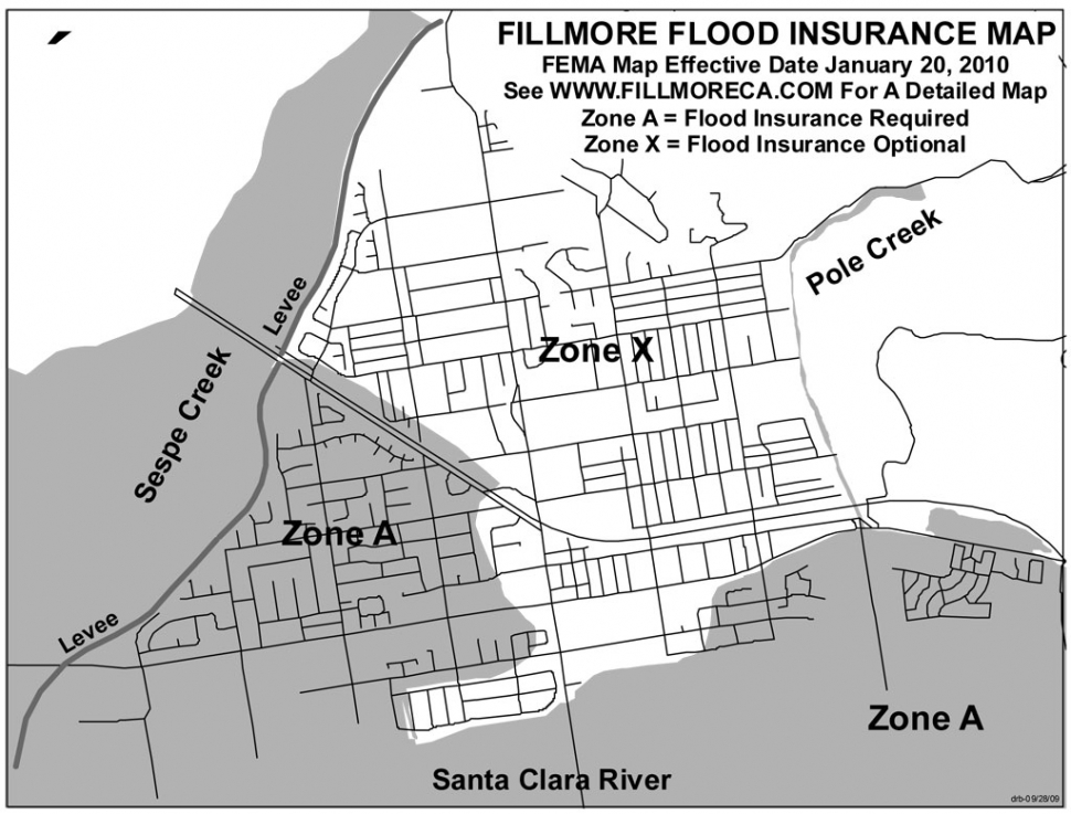
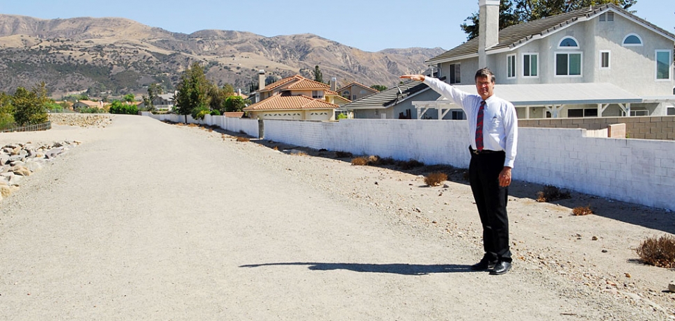 Pictured above Bert Rapp shows how high the levee should be when it is finished. On Thursday October 22nd FEMA and Ventura County Watershed Protection District representatives will update Fillmore residents on the status of the FEMA Flood Insurance update for Fillmore. The meeting will be held at 6:30 P.M. at the Memorial Building at 511 Second Street. With the new update approximately 1,500 homes and businesses will have to purchase flood insurance by January 20, 2010. The insurance will cost about $50 to $100 per month. See the attached map for the affected properties. You can see more detailed maps on the City of Fillmore web site at www.fillmoreca.com FEMA is updating the Flood Insurance Rate Maps (FIRM) for Fillmore and other communities in Ventura County. All properties that will be in a Flood Zone A on the new maps will have to purchase flood insurance when the maps become effective on January 20, 2010. If you purchase your flood insurance before the map becomes effective you can be grandfathered in at a lower rate saving about 50% on your flood insurance. FEMA will have their insurance specialists at the October 22nd meeting to fully explain the insurance options. The new flood insurance requirements are result of the FEMA policy to reaccredit levees every 5 years. As part of the accreditation review the hydrology for the Sespe Creek was updated and the theoretical 100-year flood was increased from 98,000 cubic feet per second (cfs) to 135,000 cfs. Also the computer modeling of alluvial streams like the Sespe Creek have greatly improved since the levee was designed 30 years ago in 1979. The current analysis by the Watershed Protection District indicates the Sespe Creek Levee upstream of Old Telegraph Road is sufficient however between Old Telegraph Road and Hwy 126 the levee needs to be raised as much as 6-feet midway between Hwy 126 and Old Telegraph Road. The District has not yet determined if the levee foundation needs to be deepened. The levee retrofitting cost will likely be $6.5 million or higher. All of the El Dorado mobile home park will also be in a Flood Zone A when the map becomes effective on January 20, 2010. When the Heritage Valley Parks levee is accredited by FEMA the flood insurance requirement for El Dorado should be eliminated. This may occur in the next two years. If you have questions you may call Bert Rapp at 524-1500 x 231. |