
|
Report Highlights Widespread Loss of Public Access to Los Padres National Forest
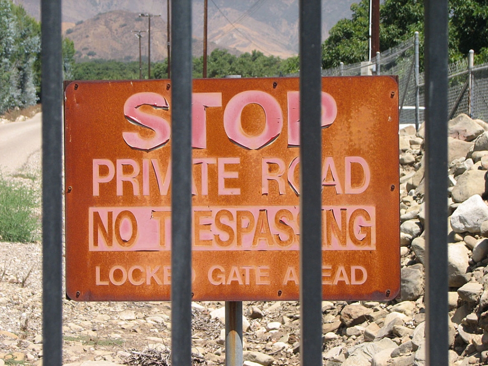 Timber Canyon Road Sign By Anonymous — Wednesday, May 30th, 2012
Release of Ten Lost Trails of the Los Padres Coincides With National Trails Day June 2
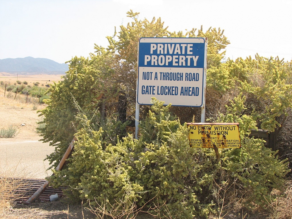 Perkins Road Sign Coinciding with the 20th Anniversary of National Trails Day, Los Padres ForestWatch today released a report documenting the gradual loss of public access to several hiking trails leading into the Los Padres National Forest. The report – titled Ten Lost Trails of the Los Padres – highlights ten trails across the Los Padres National Forest where historic public access has been restricted. Over time, as the forest’s neighboring land ownership changes, trailheads have been blocked off by gates and “no trespassing” signs, restricting the public’s access to public lands and funneling an increasing number of forest users onto a dwindling trail system. These trails have been used historically (in some instances, stretching back to the 1920s or earlier), and under California law the public has a right to continue to access these trails if there is sufficient evidence to prove the existence of historic use. ForestWatch’s report shares some success stories of trail access restored, some stories of cautious hope as community groups work to save the trails they love, and some stories of tenuous situations where access and trails are on the brink of being lost forever. The Full Report: THE TRAILS: • Middle Fork Matilija Trail, Ojai: A coalition of concerned citizens is working with the Forest Service to preserve access to Matilija Falls that has been enjoyed by the public for more than 80 years. • Santa Paula Peak Trail, Santa Paula: A gate mere yards off of Highway 126 now restricts access to the Santa Paula Peak trailhead, shutting out the public from this scenic nine mile hike to the summit. • Agua Blanca and Pothole Trails, Piru: A local water district charges an access fee of up to $13 per day for forest users to park their cars in lots four miles from the trailheads. • Hot Springs Trail, Montecito: A success story of preserved access—a local land trust recently purchased land surrounding the Hot Springs Trail and will hand over ownership to the U.S. Forest Service for public enjoyment in perpetuity. • Franklin Trail, Carpinteria: A success story of restored access—through collaboration between community groups, the County of Santa Barbara, and private landowners, the historic Franklin Trail is being re-established into the Los Padres National Forest backcountry. • Rocky Ridge and Bull Ridge Trails, Cuyama Valley: These trails, visible on Forest Service maps as far back as the 1930s, access remarkable rock outcrops in Lion Canyon, grassy meadows atop Sierra Madre Ridge, and hidden Native American cultural sites. Access has been lost due to a locked gate on Perkins Road off Highway 166. • Alamo Creek and Beartrap Trails, Lockwood Valley: These trails, visible on Forest Service maps from the 1930s and 40s as well as described in old hiking guides, have been lost due to restricted access at their trailheads. With decreased use, the trails have become overgrown, and public access to this corner of the Sespe Wilderness has been diminished. • Stony Creek Trail, Arroyo Grande: This trail, and the Stony Creek and Agua Escondido Campgrounds, have been lost as a private landowner gated access on Huasna Road out of Arroyo Grande. Included in a published collection of scenic byways in 2004, this portion of Huasna Road is no longer even passable. • DeAngulo Trail, Big Sur: A success story of preserved access—an eccentric character of Big Sur in the 1950s who willed his property for public use as long as it was maintained—volunteers have been caring for the trail ever since. • Little Sur Trail, Big Sur: A tenuous situation where users of a historic trail are encountering threatening signs and access rules imposed by private landowners with property adjacent to the national forest. “These trails are part of our heritage, and access to the national forest is a right recognized under state law,” stated ForestWatch Conservation Coordinator, Suzanne Feldman. “This report only touches on the problem of compounding loss of access to public lands; there are plenty of more trails we could be talking about and plenty of ways for the public to get involved.” LEARN MORE: Download the report at www.LPFW.org and while there sign up for a half-day of service volunteering with ForestWatch to clean up microtrash (bits of trash that are harmful to the critically endangered California condor) on National Trails Day, Saturday, June 2. Details at www.LPFW.org/index.php/calendar Serving as a local voice for land and wildlife conservation and working to return a sense of balance to our public lands, Los Padres ForestWatch is an advocacy organization that uses community involvement, scientific collaboration, and legal might to defend local forest lands from environmental threats. ForestWatch is also a land stewardship organization, working with teams of volunteers to clean up trash, remove old barbed wire fencing, and eradicate non-native invasive plants. |